The Landsat Program provides repetitive acquisition of high resolution multispectral data of the Earth’s surface on a global basis. The data from Landsat spacecraft constitute the longest record of the Earth’s continental surfaces as seen from space. It is a record unmatched in quality, detail, coverage, and value.Landsat Data Continuity Mission Overview
***
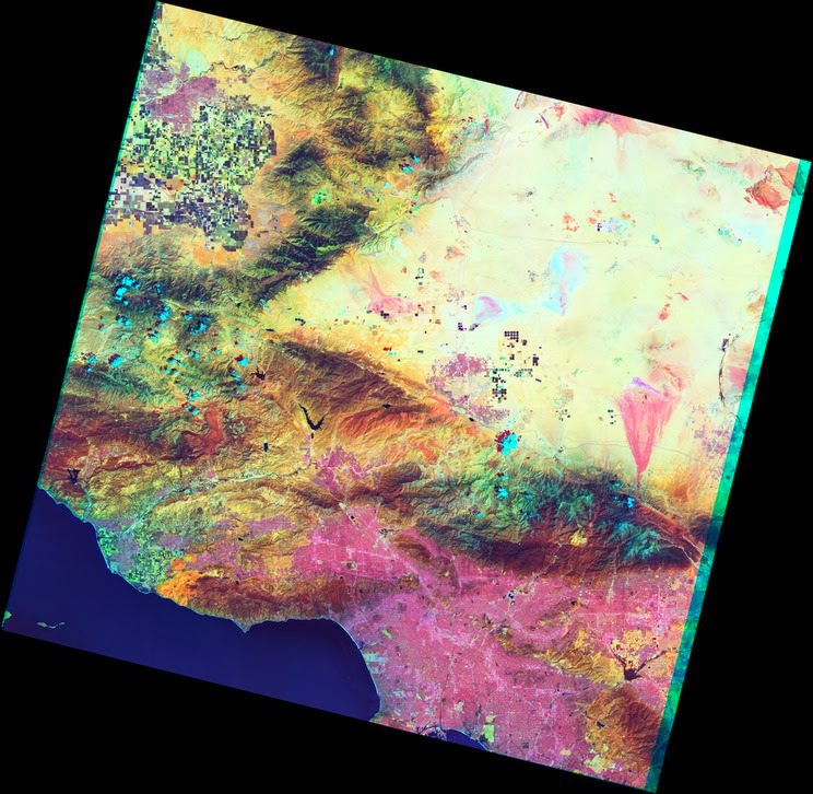 |
| Urban areas and some kinds of soil are pink. In the true-color image, wild vegetation is almost uniformly olive-colored, but here we see a distinction between peach-colored scrubland, mahogany-colored woodland, and so on. Cooling onshore breezes appear as a slight purple gradient along the coast of the city. The colored strips on either side of the image are areas where not all sensors have coverage. |
Landsat 8 measures different ranges of frequencies along the electromagnetic spectrum – a color, although not necessarily a color visible to the human eye. Each range is called a band, and Landsat 8 has 11 bands. Landsat numbers its red, green, and blue sensors as 4, 3, and 2, so when we combine them we get a true-color image such as this one: